Q&A on Designing a Successful IP Survey
Q&A on Designing a Successful IP Survey
Before the first electrode is placed, there are several decisions that determine what an IP survey can actually tell us about the subsurface.
The first step is to determine whether IP is the right method for the geological setting or exploration question. Where it is suitable, the survey still needs to be designed around the deposit model, the target’s expected depth, size, shape, and orientation, and what needs to be resolved. The appropriate design depends on the questions the survey needs to answer.
What are we looking for?
Does the target have sufficient resistivity contrast with its surroundings? Does it contain polarizable material capable of producing a measurable voltage decay?
The expected size, shape, and orientation of a target can also influence survey design. Depending on the information needed, survey lines can be oriented to cross or follow geological trends. Receiver configuration can also be selected to improve sensitivity to the expected target.
For example, a survey designed to map a broad zone of disseminated sulphides may prioritize coverage, while a survey targeting a narrower mineralized zone may place greater emphasis on spatial resolution.

How deep is this target?
Target depth is an important consideration when designing an IP survey. The deposit model and expected depth of mineralization help determine the survey’s required Depth of Investigation (DOI). DOI is the approximate depth to which the survey can provide meaningful information.
Electrode spacing and the number of measurement levels directly influence the DOI and resolution of the measured response. As a general rule of thumb, DOI is often estimated as approximately 0.25 to 0.50 x n x a, where “a” is the electrode spacing and “n” represents the measurement level. The appropriate spacing and array extent depends on the target depth, the resolution required, and the number of electrodes that can be deployed.
For example, a survey designed to investigate a shallow mineralized zone would typically use a tighter spacing strategy than one intended to evaluate a target several hundred metres below surface. The design needs to provide meaningful sensitivity at the target depth while maintaining the resolution needed to define the target’s geometry and extent.
How should the survey be laid out?
Line orientation, survey extent, and acquisition geometry can all influence the data collected and how well it addresses the exploration objective.
Where geological structure or mineralization has a known trend, survey line orientation can be selected to best intersect the expected target geometry and define its location and continuity. Where the geological model is less certain, increasing survey line spacing can assist with covering broader areas while maintaining the intended DOI that matches the target. If there is good control and understanding of the subsurface geology, and better precision for drill targeting of anomalies is required, a 3D survey may provide a more complete understanding of the subsurface.
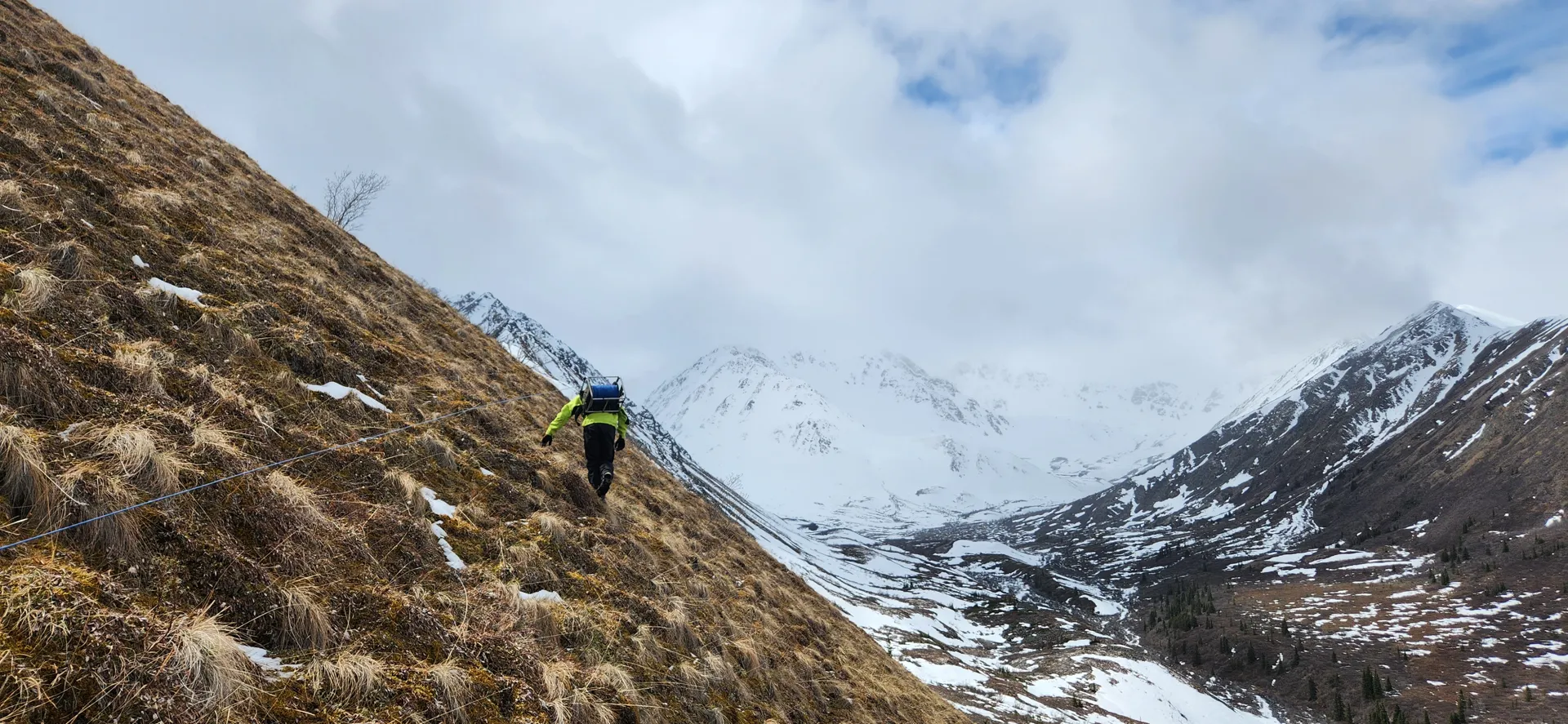
What will the field conditions allow?
Topography, access, property boundaries, cultural noise, conductive overburden, and budget can all affect how an IP program is designed and executed. Terrains such as steep slopes or difficult access can increase survey time and operational complexity, and may require adjustments to the planned survey layout. Additionally, areas with loose rocks or dry/sandy conditions can create difficulty for a survey crew to obtain and maintain a suitable electrode contact resistance. Sometimes the theoretically ideal configuration isn't the most practical one for the site. Good survey design accounts for those constraints without losing sight of the exploration objective.
In conclusion: A geophysicist designs for the question
Ultimately, effective IP survey design is about making choices before survey execution that influence the value of the data collected. Spacing, line orientation, acquisition geometry, receiver configuration, and field layout all involve trade-offs between depth, resolution, signal quality, coverage, and efficiency.
The best design isn't necessarily the most complex one. It is the one that provides the right information to address the geological question. That is where IP survey planning becomes more than choosing an array type and electrode spacing. It becomes part of the exploration strategy.
Related Services
Popular Posts





Categories
Find Us
Yellowknife
3506 McDonald Dr.
Yellowknife, NT
Canada
X1A 2H1
Whitehorse
34A Laberge Rd.
Whitehorse, YT
Canada
Y1A 5Y9
Juneau
Juneau, AK
United States
Message Us
Work
FEATURED CASE STUDIES